

No one designs a stroad on purpose
No one designs a stroad on purpose
Design by committee can be hazardous to your community's health

If stroads are so bad, then why do we have so many of them?
The core of the problem is that a community’s needs change over time. As those changes occur, some people remember what it was like before and want to keep it that way. Others see small changes that “won’t hurt all that much.” Few have a vision for what can be. Fewer still can share that vision in a way that everyone else can keep it for their own.
In essence, we have a road designed by a governmental committee.

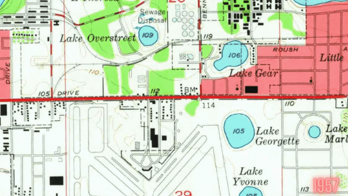
Here’s what this looks like in real life. The east side of Orlando grew pretty quickly from the 1950’s to today. What was fairly vacant and served basically only the military base has become a bustling commercial center. However, unlike the commercial centers that have grown up in gridded network with compact walkable areas, it was oriented toward the major east-west corridor across Florida. Today, it looks like this:
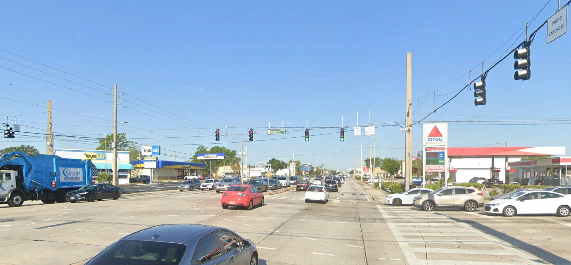
What a mess!!
In a vehicle oriented culture, the major road is your major advertising. All the land use is tucked behind massive parking lots, but visibility to the cars driving by means survival. (That’s probably why we lost our Chi Chi’s there. It’s been gone for 30 years and I still can’t believe it didn’t make it.) In the 1950’s it was largely vacant fields around the small municipal airport. As you can see, they’ve gone overboard on the pedestrian features, but no one in their right mind would love walking here. This is what the development looked like over time:
The traffic is terrible, but that’s life in a vehicular world. Ped/bike crashes are a mess too, but most folks know better. Then in the last few years, the old military base was converted to a walkable/bikeable community. That’s fine as long as they stay in that area, but the truth is they shouldn’t have to. There’s really great stuff to be done along the SR 50 corridor. It’s not that far to go on a bike, but I wouldn’t recommend it.
SR 50 is pretty terrible these days for long distance travel. It’s fine for a mile or so, but much more is nightmarish. There’s a toll road that carries that long distance travel just off the south side of the screen. The problem is that what used to be a state-spanning arterial now has so much local traffic, it’s not good for that purpose anymore, but parallel network is minimal at best. That means there really aren’t that many options for east/west travel, so everyone uses the only route they have. (Can you see why I harp on network?!?!) Because the properties have a bunch of different depths, it’s also hard to create a parallel bike or pedestrian network. Now that everyone wants to find a way to use their E-bike or walk around, there’s not a good way to do that.
We need that corridor for getting around. We need that corridor for getting into businesses. We’d like to have the corridor serve those that want to use bikes and walk. What is the solution?
Choose.
Ultimately, the problem is that we’re trying to do too much in one spot. Is this going to be a through street or a neighborhood street? It’s pretty clear: that choice has already been made. At 7 lanes wide, it’s too wide to function as a local access road. There’s no way you’re going to get people to slow down.
But that means we also need a secondary network for access and non-motorized users. As the properties redevelop, it’s going to be important to create the parallel network connections through the buildings for these users. We still need properties to be seen from the high volume road, but it’s fine for them to back up to that road instead of face it with a parking lot. We need a set of bike trails and low speed streets that aren’t on SR 50 so that those modes can have their own space!
Getting the “Committee” on the same page
Until we can get everyone in that messy government committee to make the intentional choice to provide parallel systems, vision zero and functional ped/bike operations are a pipe dream. Orlando has made a lot of progress on that score.
The good news is that they’ve already done a good job of fixing a similar roadway around the corner. Mills Avenue is only 5-lanes, but it’s just as big a mess. However, the Orlando Urban Trail runs parallel to it and behind the buildings. I stumbled on the trail a few years ago and fell in love. It runs behind the local Fresh Market and near most of those old buildings that are fronting the messy road. I’d rather be behind it anyway—closer to the entrance.
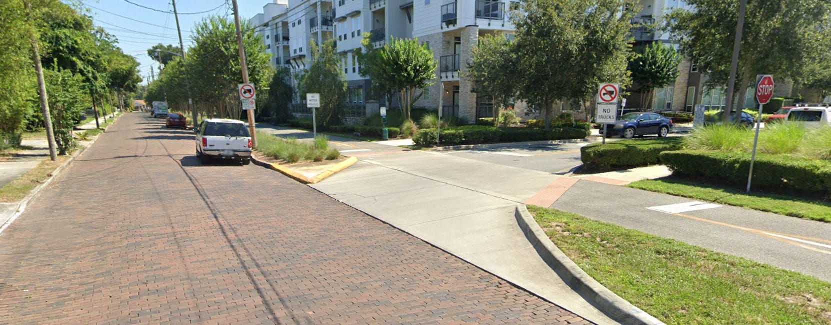
Mills had a head start because it already had a roadway network. That’s one reason I keep saying that if you have a street network, you can fix the multimodal world within a decade. It’s a lot harder when you need to create that network, but it can be done.
Action steps:
So what can you do? First of all, if your community doesn’t have a ped/bike masterplan, it’s never too late to start. Get together with your development community and encourage them to start thinking A, B, and C streets. It’s ok to minimize the multimodal provisions on a road you have chosen to be a road, but you absolutely need to have a parallel facility for them. Even better if you can get it up next to the fronts of the building.
Next up:
I may not make it to the Mental Frameworks post at the end of the week, but I’ll be back early next week.